Infrared technique could be used to audit greenhouse gas sources such as factories, power stations and farms
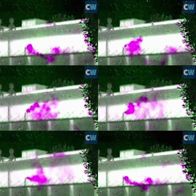
Researchers in Sweden have developed a new camera that can visualise the flow of methane – a key greenhouse gas – as it emanates from its source. In one piece of footage the team has shown a plume of methane spilling from a window in a barn housing cows. The camera, which uses a technique called optimal infrared hyperspectral imaging, can also quantify the amount of gas being produced and could be useful in producing accurate audits of the sources of methane.
Despite methane’s environmental importance, our knowledge about how it is cycled remains incomplete. Satellite observations can detect methane at the global and regional scales, and individual measurements can provide data at point sources, but information about methane fluxes at the scale of metres has so far been missing.
Now, Magnus Gålfalk of the University of Linköping University and colleagues have plugged this gap. The new camera relies on the unique infrared (IR) absorption or emission profiles of different gases. Molecules will absorb or emit IR depending on whether the background is hotter or colder than the gas. The pattern of absorption or emission lines can be used as fingerprints of chemical compounds. The camera records the data at a high frequency, making many thousands of measurements over a period of seconds, which allows it to track the movement of the gas over time.
‘In this way we do not just detect the source, but we also see the flux,’ says Gålfalk. ‘When we looked at a cow barn, initially we were focused on a pile of manure outside, but then in the corner of the image we noticed a large amount of methane coming from of a ventilation outlet – which gave us a bit of a surprise.’
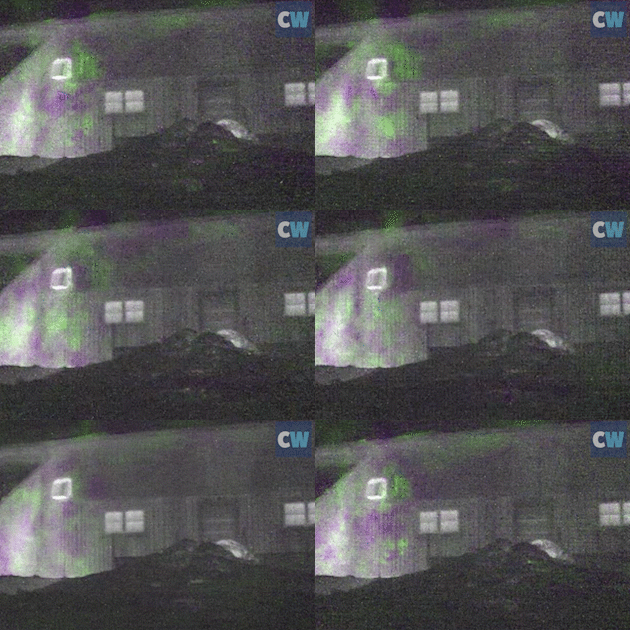
The researchers have shown that methane flows can be detected and quantified from a range of sources, including a waste incineration plant and from sewage sludge.
Gålfalk says that the camera can detect methane from a distance of around 700m, which would allow it to be carried in a helicopter to obtain data about methane emissions from sources such as forests or lakes over a large area in a relatively short time.
‘This new technique complements very nicely the methane observations we obtain from satellites such as GOSAT and IASI, which provide a useful global and regional picture but are unable to resolve individual point sources of methane well enough to accurately quantify their emissions,’ says Neil Humpage, who develops methods for atmospheric remote sensing of gases at the University of Leicester in the UK. ‘Also, the technique is especially timely given the present need to assess and report the anthropogenic contributions towards atmospheric carbon arising from different sectors, such as power generation, agriculture and transport.’
References
M Gålfalk et al, Nat. Clim. Change, 2015, DOI: 10.1038/nclimate2877

No comments yet